Snowstorms
El Niño and BLIZZARD (the novel)
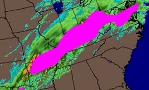
As you’re undoubtedly aware, a powerful El Niño is expected to exert heavy-handed authority over our weather this winter. And before I go any further, please, please, please remember El Niño is NOT a weather phenomenon. It’s the name given to a particular Pacific Ocean temperature regime. El Niño exerts an influence on weather patterns,…
Read MoreBehind the scenes–forecasting snowstorms
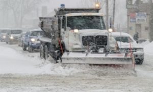
It’s been quite a winter so far. This morning, winter storm warnings blanket New England as the second major tempest–a true blizzard near Boston–in a little over two weeks mounts a furious assault. It’s already dropped 6 to 12 inches on NYC. Winter storm warnings are also in effect for much of Washington state, northern…
Read MoreEight plows?
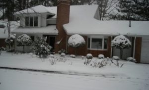
To say this has been an interesting winter so far would be a healthy understatement. As I write this, the largest city in the South remains wrapped in a blanket of white and virtually shut down for the second day in a row. What little traffic there is creeps like a garden slug on a…
Read MoreDo they make you do it?
As I write this, bitter cold arctic air is slashing eastward and southward across the eastern two-thirds of the nation, and a pugnacious winter storm is aborning over the Southwest. Thus, the stage is set for a blitzkrieg of ice and snow from New Mexico to North Carolina over the next 48 hours. Curiously enough,…
Read MoreSack and Pillage Alert
All one has to do in the Deep South is mention “snow” or even “snow flurries” in a weather forecast, and it’s a given that residents will descend upon local grocery stores like barbarian hordes. All milk and bread will disappear from shelves within 12 hours. The sacking of Kroger. The pillaging of Publix. Now,…
Read More